Transcontinental Journey
01/04/10 10:43 PM • Category: Panama
In many parts of the world a transcontinental trip is a big deal, requiring significant planning and days (if not weeks) of travel often under less than great conditions. Not so in Panama where people live on one coast and work on the other, riding the world's first transcontinental railroad (established in 1855) or driving the newly opened Corredor Norte (tollroad) on their daily commute. We even have vantage points in Panama where you can actually see both oceans at the same time. Not surprisingly, our transcontinental journey is more akin to a leisurely Sunday outing than an expedition as we can travel from the Pacific to the Atlantic (Caribbean) in under an hour whenever we want to do a little exploring.

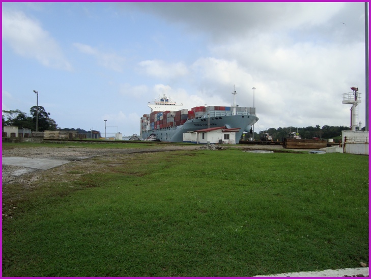
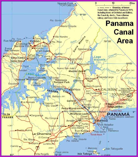
Our first destination was Fort San Lorenzo - but first we had to cross the Panama Canal and this turned out to be the highlight of this trip. Why? Because on this end of the Canal there are no big suspension bridges - the entire area on the other side was a U.S. Army base (Fort Sherman) and off-limits to civilians, so no need for a big bridge. Instead, you drive INTO the Canal and cross on a little swing bridge to reach the other side. It's one of the few places on earth where you look UP at VERY LARGE ships. Pretty neat.
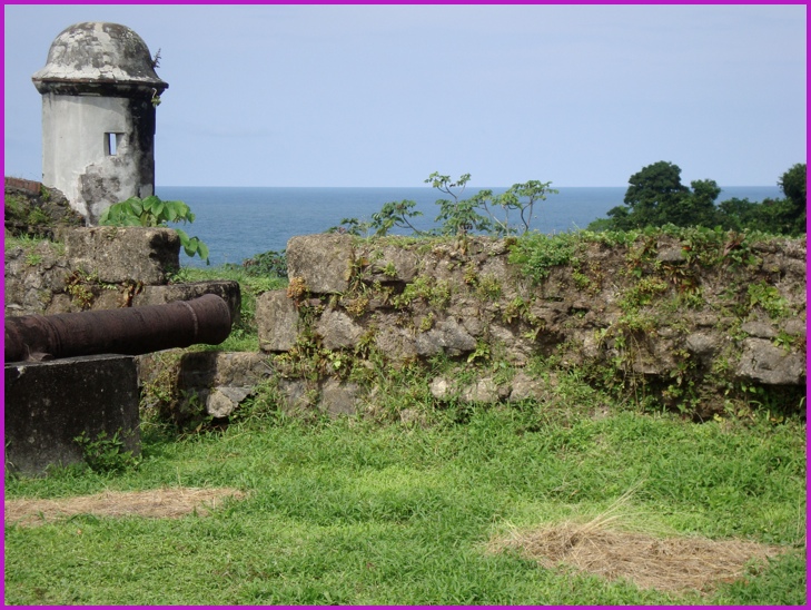
Once on the other side it's off to Fort San Lorenzo (upper left corner on the map). Originally built in 1597 (they think), destroyed by Henry Morgan and then English Admiral Edward Vernon, the present ruins are from the 1750 rebuilt. The fort sits on a point of land - with the Caribbean on one side and the Chagres River on the other. The views were great and although there hasn't been much restoration, they have a nice series of signs that provide interesting information about the area and the fort. Worth the trip, next time we'll take a blanket and picnic lunch.
After San Lorenzo we head for Portobelo (upper right corner on the map) to check out another old fort. We make the another Canal crossing at Gatun Locks and find the road that had eluded us on an earlier trip. Nice drive, but the fort wasn't all that impressive (did have a lot of cannon and overlooked a small harbor). We walked around for a bit then hit the road. We then tried to find a new outdoor adventure place (zipilne tour, tubing, hiking) but their road had been washed out - next time we'll give them a call to check.
A stop to check out a woodworkers shop and then we're on the road back to Panama City. It was a fun day and as far as transcontinental journeys go - a piece of cake.
 Watch the video version of our journey.
 Take care.